+1 866 300 9012   contact@measur.ca
SHOPPING CART

No Products in the Cart

TOTAL:
$0.00

DJI Matrice 30 Series Firmware Update (Nov 2022)

DJI has recently released a new firmware update for the Matrice 30 Series, bringing optimizations to smart inspections, enhancements to mapping operations, support for downloading global elevation data, burn protection for the M30T thermal camera and more. The new update not only provides drone pilots with more efficient route planning mechanisms, it also offers organizations improved data quality aiding in appropriate decision making.

What you will find in this new firmware update

1. A new automatic target frame:

The system now automatically frames the target area of the shot sample collected after the mission recording is completed. This eliminates the need for manual framing.

2. New recovery metering functions: 

These functions aid in the recovery of low-light shots by recording the brightness value and other parameters of the sample shot during task recording, improving the data quality even during evening hours.
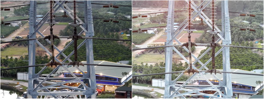
Unrestored metering on the left vs Restored metering on the right 

3. AI-assisted zoom stabilization:

Smart inspection is not longer affected by RTK signal error, strong wind, etc, when using the zoom lens to find and capture its target. The new algorithm searches and matches the framed target from the wide-angle screen to help correct the camera shooting angle, this ensures the shot of the target object is accurate. In addition, the drone does not need to change its position frequently given the right distance. A single waypoint can photograph multiple target objects accurately, improving operation efficiency. 

4. Optimized non-photo waypoints:

The drone does not longer need to decelerate as it arrives at non-photo waypoints placed for safety purposes. The new update provides the option to maintain the drone speed, further improving efficiency and saving battery life.

5. Greater mapping accuracy:

The M30 series is ideal for building a map to help aid emergency efforts, and various mapping jobs, such as to quickly obtain valuable information to assist at construction or mining sites, and building stockpile volume measurements. 
The new upgrade offers greater mapping accuracy by taking the synch time between the camera, flight controller, RTK, and gimbal system, to the microseconds. For instance, vertical accuracy of 22.3cm can be achieved, when working with a GSD of 5.01cm/px, a flight altitude of 141m, a flight speed of 7.5m/s, and horizontal accuracy of 13.9cm.

6. Support for downloading global elevation data:

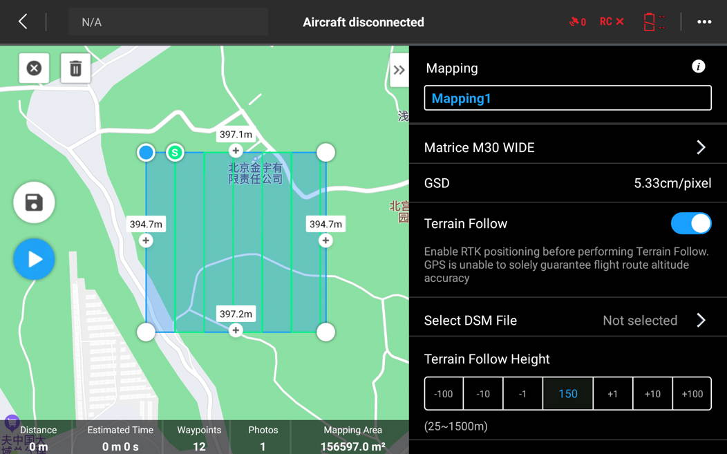
The new upgrade supports direct download of global elevation data through Pilot 2, eliminating the need to import DSM files to obtain terrain information. This new support enables terrain following flight missions. However, the accuracy error of individual areas is large, so it is recommended to verify before use and keep an eye on the flight environment during operation to ensure flight safety.
Choose to import locally or download
Select the DSM file after opening the ground simulation flight

7. Burn protection for the M30T thermal camera:

The new upgrade adds a layer of burn protection to the M30T camera. Given the delicate nature of infrared cameras, this new update reduces the possibility of damage, helping prolong the life of your drone.
Please visit the M30 downloads page to access this latest firmware version.

For industry leading technology within the commercial UAV drones, contact a member of our team today to find the right equipment for your application.

CONTACT US

Want to get in touch with us? Just fill out the form below and we'll get back to you ASAP.

BACK TO TOP