No Products in the Cart


49 MinMax Flight Time |
1/1.5″ CMOSTele Camera |
48 MPMedium Tele Camera |
4/3 CMOS, 20 MPWide-Angle Camera |
640 × 512Infrared Thermal Camera |
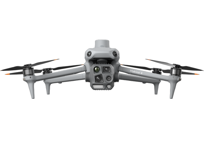
The DJI Matrice 4T combines versatility, intelligence, and safety for critical missions. Its advanced multi-sensor payload and powerful AI capabilities ensure you can meet the demands of any operation with confidence.
High-Performance Cameras• Wide-Angle Camera: 1/1.3″ CMOS, 48MP Effective Pixels, f/1.7, Format Equivalent: 24 mm. • Medium Tele Camera: 1/1.3″ CMOS, 48MP Effective Pixels, f/2.8, Format Equivalent: 70 mm. • Tele Camera: 1/1.5″ CMOS, 48MP Effective Pixels, f/2.8, Format Equivalent: 168 mm. • Infrared Thermal Camera: Resolution of 640 × 512, High-Res Mode for detailed thermal imaging. |
 |
 |
Night Vision and Low-Light Performance• NIR Auxiliary Light: FOV: 6°, Illumination Distance: 100 m, perfect for wildlife protection and search and rescue. • Night Scene Mode: Supports Full-Color night vision with enhanced noise reduction and IR Cut Filter for clear visuals in darkness. • Smart Low-Light Photo: Capture clear images even in the most challenging lighting conditions. |
Detect and track vehicles, individuals, and other subjects in real-time. Smart tools like Cruise, FlyTo, and POI enhance operational efficiency.
The Cruise feature allows for hands-free navigation, enabling long-distance flights without constantly adjusting the control sticks.
In emergency situations, the Fly To function automatically adjusts the drone's flight path and speed to reach a designated location without manual input.
The Smart Track feature helps maintain precise subject positioning and automatic zoom adjustments, even reacquiring subjects if briefly obstructed.
Finally, the POI (Point of Interest) function enables continuous observation and 3D modeling of buildings by flying around a specified area, improving the efficiency of fixed-point observation and modelling tasks.
|
Gimbal Following Spotlight |
Real-Time Voice Speaker |
New D-RTK 3 Multifunctional StationThe D-RTK 3 Multifunctional Station represents a significant advancement in GNSS technology, featuring high-performance antennas and receiver modules that are capable of tracking and resolving data from major global satellite navigation systems. This robust system supports multiple data transmission links, making it incredibly versatile. It can function as a base station to provide centimeter-level positioning for multiple drones at once or operate in relay station mode to extend a drone's operational range. Additionally, the integration of the new rover station mode, paired with the DJI Enterprise app and DJI Terra, delivers a comprehensive solution for high-precision aerial surveying applications, ensuring both secure and accurate operations for a wide variety of professional use cases. |
 |
 |
Enhanced Software SolutionsDJI's suite of software solutions has been enhanced to better support industrial applications, with significant updates to DJI Pilot 2, FlightHub 2, and DJI Terra. DJI Pilot 2 now features a customizable intelligent function toolbar and supports various flight route types, along with virtual space models and route preview functions for improved operational efficiency. The integration with FlightHub 2 facilitates enhanced drone control and cloud information sharing, reducing the workload for pilots. FlightHub 2, specifically designed for the Matrice 4 series, offers advanced flight planning options such as remote takeoff/landing, Smart 3D Capture, and the ability to control both the aircraft and payload simultaneously through Live Flight Controls. It also supports synchronized livestreams during multi-drone operations for a streamlined air-ground experience. DJI Terra further complements these tools by offering high-precision camera distortion correction, offline PPK processing, and the ability to import D-RTK 3 data, improving the accuracy of 2D, 3D, and point cloud models for applications in areas like geographic information, emergency response, and construction planning. |


