+1 866 300 9012   contact@measur.ca
SHOPPING CART

No Products in the Cart

TOTAL:
$0.00

Geomatics Equipment

Advanced Geospatial Solutions for High-Accuracy Surveys

Surveying plays a crucial role in construction and land development, providing the accuracy needed for precise measurements and mapping.


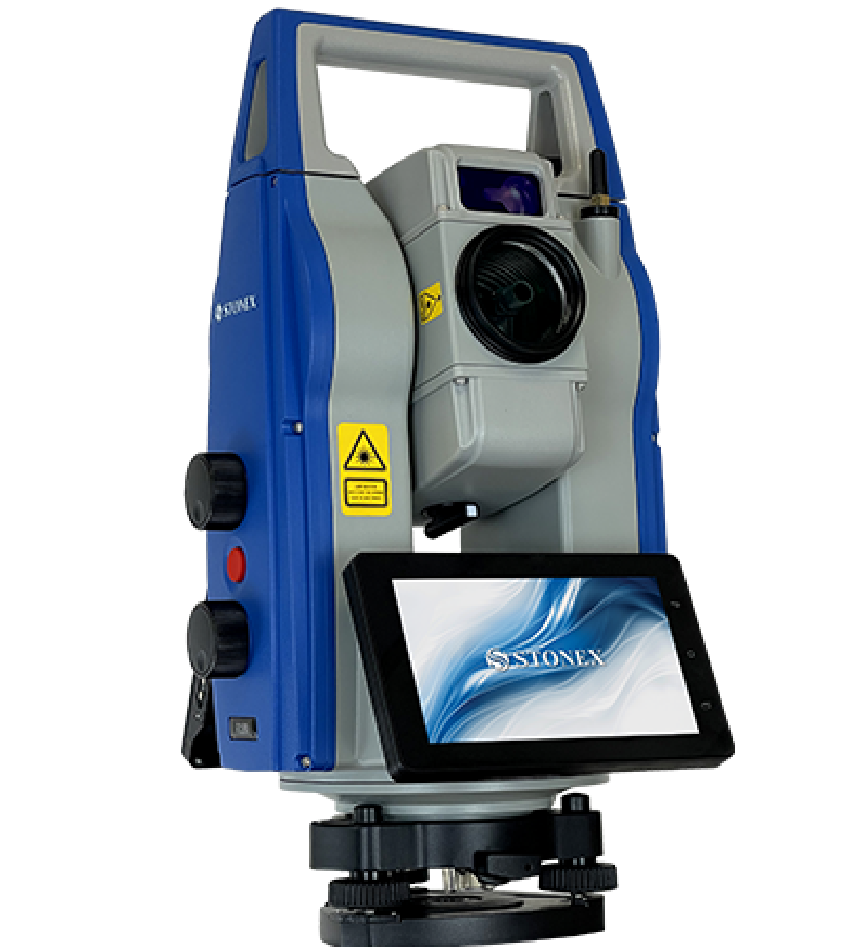
Measur is your trusted source for top-tier surveying equipment, including GNSS Systems, Hydrographic Sensors, 3D Laser Scanners, Total Stations, Drones, and much more. These solutions are designed for professionals in industries like land surveying, construction, and geospatial analysis, helping you tackle complex tasks with ease and precision.

Surveying involves using specialized tools such as Total Stations, 3D Laser Scanners, and drones to measure distances, angles, and elevations. The data collected is then processed to create detailed maps, benchmarks, and reference points essential for successful construction projects.


The right equipment is key to ensuring your surveys are both accurate and reliable.

Choosing the Right Surveying Equipment

With technology evolving rapidly, selecting the right equipment for your project is more important than ever. When choosing your tools, it's essential to consider factors like accuracy needs, terrain conditions, and budget. The right equipment ensures that your surveying process is smooth, efficient, and delivers the high-quality results you need.

3D Laser Scanners

Selecting the right 3D laser scanner for surveying involves assessing your project's accuracy requirements, range, and environmental conditions. Prioritize a scanner with suitable resolution, portability, and durability for fieldwork. Ensure it integrates with required softwares and equipment while offering good value within your budget.

Learn More

GNSS Receivers

Choosing a GNSS receiver for surveying requires evaluating factors such as positioning accuracy, signal reliability, and operational range. Consider whether you need a single-frequency or multi-frequency receiver based on your project's precision requirements and if it offers support correction services like RTK for real-time accuracy. Portability, durability, and battery life are key for fieldwork, while smooth integration with your software and equipment improves efficiency.

Learn More

MeasurNET

MeasurNET enhances surveying accuracy by providing cm-level, real-time corrections through a network of GNSS base stations. When choosing a VRS network, assess its coverage area to ensure it supports your project locations. MeasurNET offers a nationwide coverage. The system’s reliability and availability of correction data are crucial for uninterrupted operations. MeasurNET offers robust infrastructure with minimal downtime. Additionally, its ease of integration with GNSS receivers ensures a seamless setup.

Total Stations

The right total station for your surveys depends on your accuracy needs, working range, and other conditions. Consider between robotic or manual models based on your workflow, with robotic options being more efficient for solo operators.  Evaluate the instrument’s angular and distance measurement precision, as well as its ability to handle challenging weather or terrain. Features like Bluetooth connectivity and onboard software enhance data transfer and processing. A durable, field-ready design ensures reliability, making total stations indispensable for tasks like topographic mapping and construction layout.

GEOMATICS NEWS

Get in Touch

Give us a call or drop by anytime, we will answer all enquiries within 24 hours on business days. We will be happy to answer your questions.

BACK TO TOP