No Products in the Cart
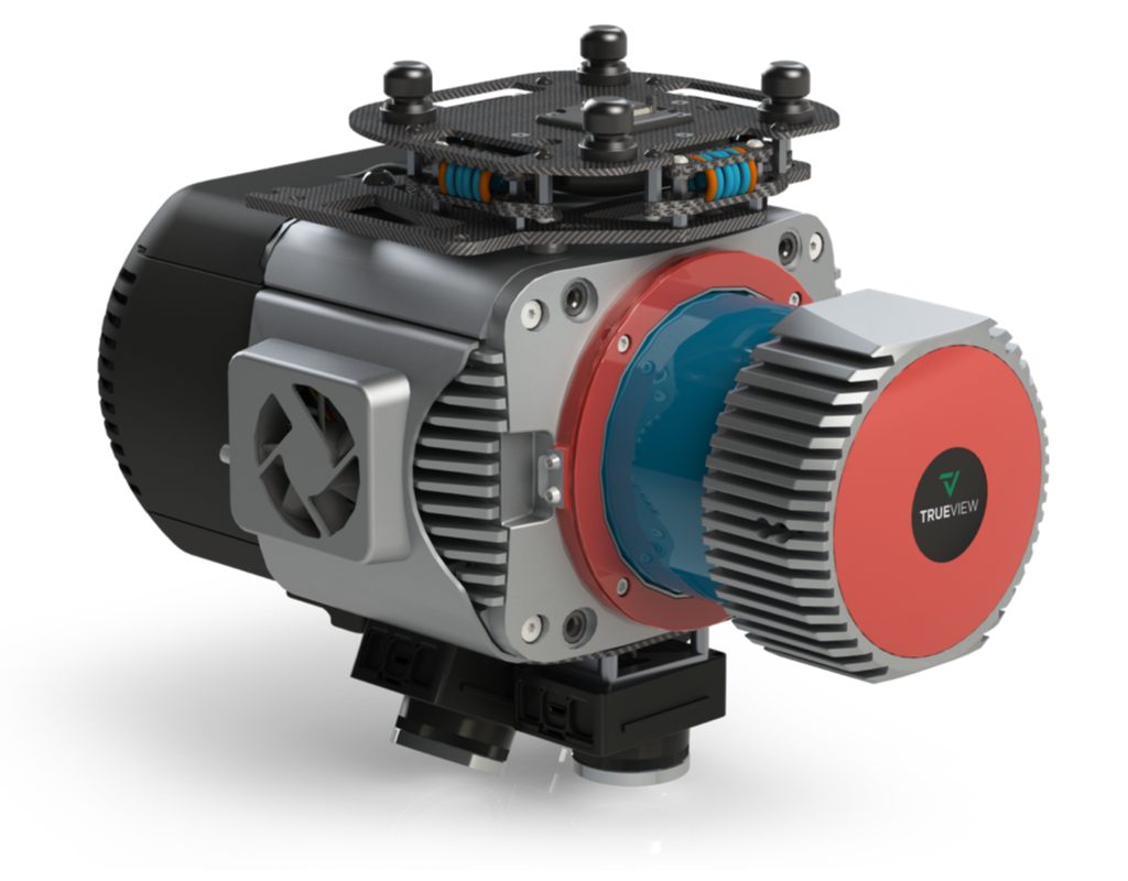
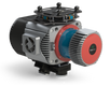
Meet TrueView 680/680LR, GeoCue’s most advanced 360° LiDAR + imaging system, featuring triple camera arrays for maximum detail and a choice between two powerhouse LiDAR sensors:
680: RIEGL VUX-1UAV-22
680LR: RIEGL VUX-1LR-22 for extended range
TrueView 680/680LR delivers exceptional accuracy, high point density, and flexibility, all in an NDAA-compliant, upgradeable platform.
|
LiDAR Precision |
Compliant |
Total RGB |
Up to |
5 mm |
NDAA |
3 x 20 MP
|
15 Returns |
Dual Mapping ModeUse in the air (drone-based) or on the ground (vehicle-mounted) 3D Imaging Sensor vs. Standard LiDARUnlike standard LiDAR systems that produce monochromatic point clouds with basic attributes like position, intensity, and scan angle, the TrueView 3D Imaging Sensor integrates RGB imagery to generate fully colourized 3D point clouds. This added visual context makes it easier to interpret features, improves classification accuracy, and enhances overall project insight and communication Fully NDAA-CompliantReady for sensitive government and enterprise projects
|
|
|


| Feature | Details |
|---|---|
| Data Collection | LiDAR + Imagery |
| Laser Scanner |
(680) RIEGL VUX-1UAV-22 | (680LR) RIEGL VUX-1LR-22 |
| LiDAR Beams / Returns |
Up to 15 |
| Positioning and Orientation System |
Applanix APX-20 |
| Pulse Repetition Rate |
(680) 800 kHz @ 120 m | (680LR) 1500 kHz@120 m |
| Scanner Precision |
680 680LR |
| Scanner Accuracy |
680 Accuracy: 10 mm 680LR Accuracy: 15 mm |
| GNSS/INS Position Accuracy |
Position: 20-50 mm
|
| GNSS/INS Angle Accuracy |
Angle: 0.015 deg Roll/Pitch, 0.035 deg Heading
|
| System Performance | Precision observed on one Strip: Typical 10 mm, Less than 10 mm (1 sigma) observed at 80 m on concrete Accuracy: Typical 3 cm RMSE, better than 5 cm 3D RMSE – depending on GNSS conditions, accuracy of control points and coordinate system |
| Camera Sensor | 3 Sony IMX-183: 1”, 20 MP, RGB -> 60 MP per payload |
| Mass | 4.97 kg (payload unit only - no accessories including battery, mount, antenna, power adapter) |
Looking for more? We’ve got you covered:
It integrates seamlessly with major drone platforms such as:
DJI. Inspired Flight, Skyfront. Freefly, Wispr, Harris Aerial, XER
TrueView 3D imaging Sensors are designed and manufactured in our Huntsville, Alabama, USA facilities.