+1 866 300 9012   contact@measur.ca
SHOPPING CART

No Products in the Cart

TOTAL:
$0.00

How to Select the Best Drone-Based Ground Penetrating Radar

Ground Penetrating Radar (GPR) technology has transformed how we explore and understand what's beneath the surface, making it an essential tool in fields like archaeology, construction, and environmental monitoring. When choosing the right GPR system, several factors come into play, including the depth of investigation, the size of the equipment, the frequency of the radar, and its compatibility with drones or terrestrial surveys. In this blog, we'll explore some key considerations when choosing a GPR system and highlight three options from SPH Engineering's Radar Systems: the Zond Aero 1000, Zond Aero 500, and Zond Aero LF.

How GPR works

Ground-penetrating radar (GPR) operates by sending radar pulses into the ground to detect and image underground objects and structures. The GPR transmitter emits electromagnetic energy, which travels through the soil. When this energy encounters an object or a boundary between materials with differing dielectric permittivity (a property that affects the speed of electromagnetic waves), part of the signal is reflected back to the GPR's receiving antenna. The system’s electronics then capture and record these variations, creating a detailed image of the subsurface.

Key Factors to Consider When Choosing a GPR

Frequency and Depth Penetration

The center frequency of the GPR antenna determines how deep the radar waves will penetrate and the resolution of the data. Lower frequencies penetrate deeper but offer lower resolution, while higher frequencies provide more detailed images but are limited to shallower depths.

Weight and Portability

Depending on your fieldwork conditions, the weight of the GPR system may be critical. If you're using a drone for aerial surveys, you'll want to ensure that the GPR is lightweight and can be mounted securely on the drone. Alternatively, for ground surveys, portability and ease of transportation are important.

Environmental Resistance

GPR systems are often deployed in challenging environmental conditions. Ensuring that the system is durable and resistant to factors like extreme temperatures, humidity, and dust can extend the life of the equipment and ensure reliable performance in harsh environments.

Integration with Drones

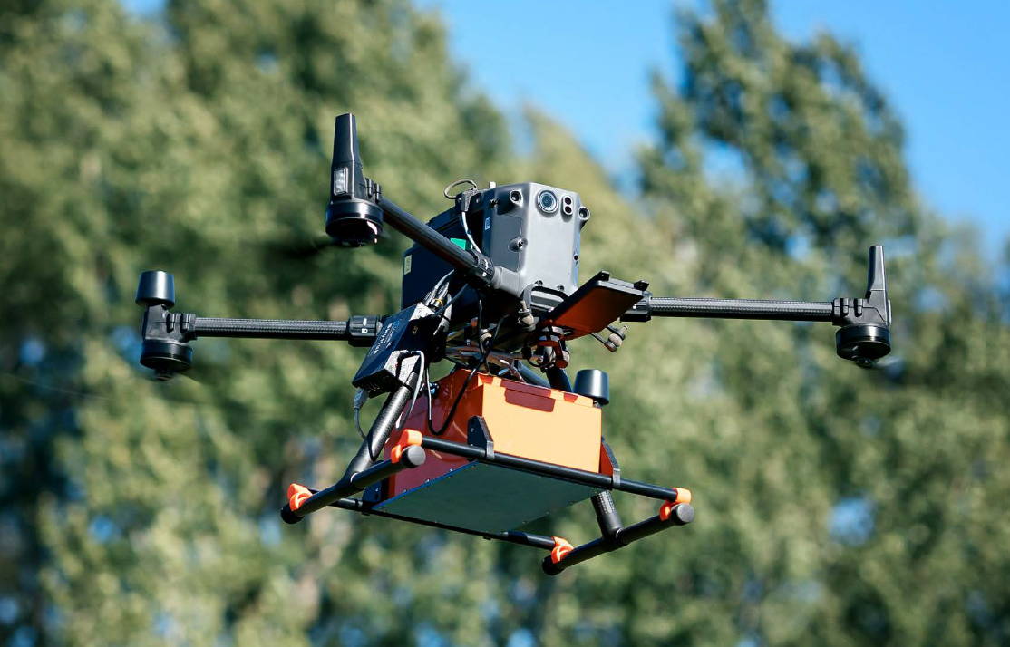
As drone technology advances, many GPR systems are now designed to be mounted on various drones, enabling faster and more efficient data collection over large areas. Compatibility with drones such as the DJI M350 RTK or M300 RTK is essential for those considering aerial surveys.

Data Processing and Formats

The data collected by GPR systems must be processed and analyzed to produce useful results. It's important to consider the software included with the GPR system and the format in which the data is provided, especially if you'll be integrating the data with other geophysical tools.

SPH Engineering's Radar Systems GPR Options

Zond Aero 1000

The Zond Aero 1000 is a high-frequency GPR system designed for shallow, high-resolution surveys. Ideal for aerial drone surveys, it is equipped with a 1000 MHz antenna, making it suitable for applications requiring fine detail within the upper layers of the subsurface.
Key Features:

• Frequency: 1000 MHz, with an operating bandwidth of 600-1300 MHz.
• Depth: Up to 2 meters, depending on ground properties.
• Weight: 1.7 kg in airborne configuration.
• Compatibility: DJI M300 RTK, M600 Pro drones.
• Data Output: 16-bit digital raw data in SEGY format.
• Operating Conditions: -20°C to 60°C, IP68 ingress protection (in a protective box).
• The Zond Aero 1000 is an excellent choice for high-detail surveys in areas where shallow penetration is acceptable, such as archeological sites, utility detection, or shallow environmental studies.
The Zond Aero 1000 GPR system flying at an altitude of 0.6 meters over a sandy soil range. Known test targets were successfully detected, and in several profiles, the interface between the sand and the original underlying soil was clearly visible at a depth of 0.5 to 0.7 meters.

Zond Aero 500

A versatile mid-frequency system, the Zond Aero 500 is suited for both aerial and ground surveys. With a 500 MHz antenna, it strikes a balance between penetration depth and resolution, making it a go-to option for a wide variety of survey types.
Key Features:

• Frequency: 500 MHz, with an operating bandwidth of 200-900 MHz.
• Depth: Up to 4 meters in average normal soil.
• Weight: 2.1 kg in airborne configuration.
•  Compatibility: DJI M300 RTK, M600 Pro drones.
• Data Output: 16-bit digital raw data in SEGY format.
• Operating Conditions: -20°C to 60°C, IP68 ingress protection (in a protective box).

The Zond Aero 500 is a versatile choice for users needing more penetration depth while maintaining resolution, ideal for construction, environmental surveys, and utility mapping.

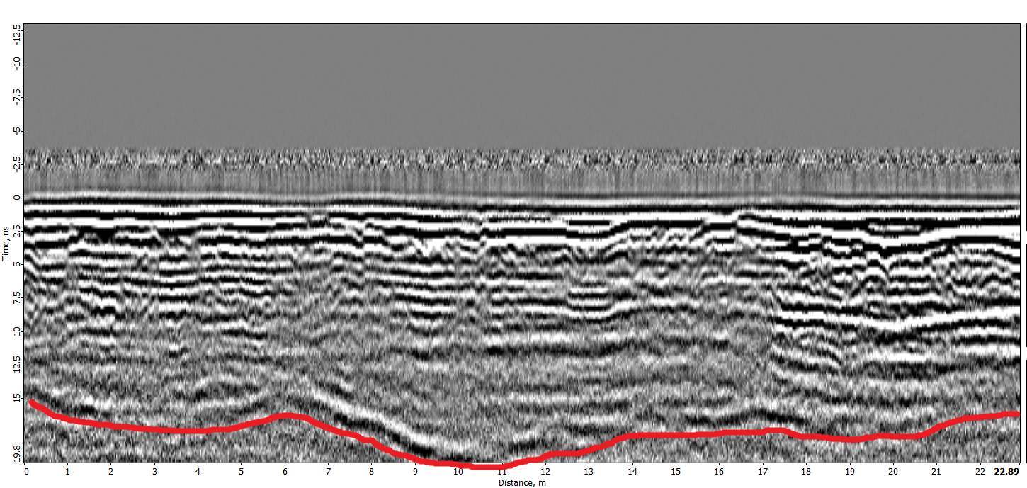
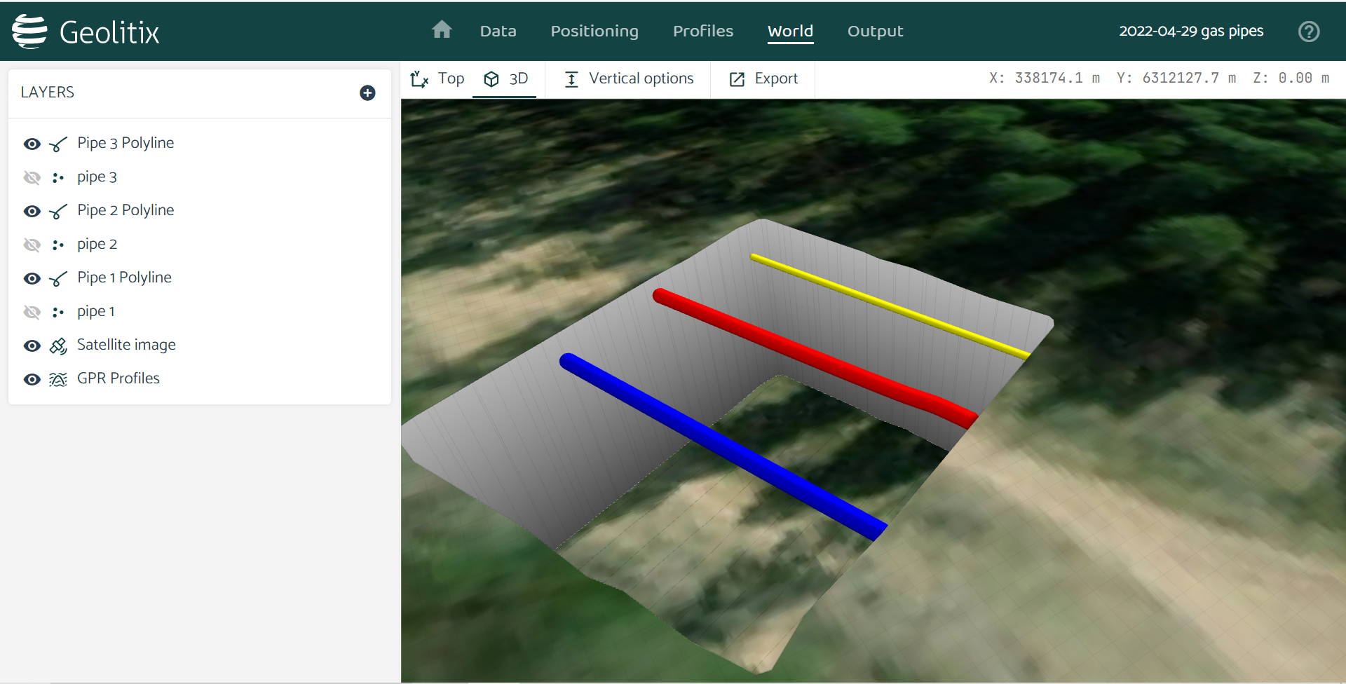
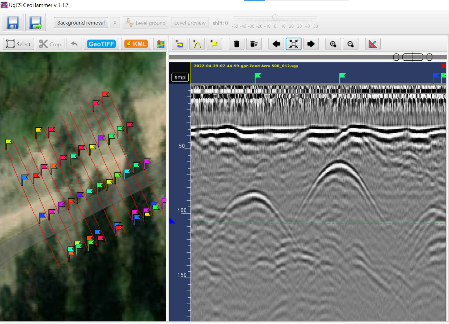
Zond Aero 500 data with gas pipelines. Drone: DJI M300 RTK. Drone equipped with UgCS SkyHub onboard computer and terrain following system. Flight altitude: 2m AGL. Flight speed: 1m/s

Discover the Zond Aero 500 NG

"NG" in the context of SPH Engineering refers to Real-Time Sampling (RTS) technology, featuring a high-performance, FPGA-based controller used across all models. This advanced system enables high hardware stacking, offering sample rates of up to 1,280,000 samples per second and scan rates of up to 2,500 scans per second, depending on the hardware configuration. It provides 32-bit digital raw data output with time ranges per sample as low as 71 picoseconds. The technology represents significant advancements in real-time data collection and processing.

Zond Aero LF (Low Frequency)

The Zond Aero LF offers low-frequency options for deeper penetration surveys. It comes with three sets of dipoles for frequencies of 100 MHz, 150 MHz, and 300 MHz, making it highly adaptable for various survey needs. With its lightweight design and advanced Real-Time Sampling (RTS) technology, it is suitable for both airborne and ground surveys.
Key Features:

• Frequencies: 100 MHz, 150 MHz, and 300 MHz.
• Depth: Up to 12 meters in soil, depending on conditions.
• Weight: 0.8 kg (controller), 0.1 kg (300 MHz antenna), 0.2 kg (150 MHz antenna), 0.4 kg (100 MHz antenna).
• Compatibility: DJI M300 RTK, M600 Pro drones.
• Data Output: 32-bit digital raw data in SEGY format.
• Operating Conditions: -20°C to 60°C, IP68 ingress protection (in a protective box).

This system is perfect for applications requiring deeper penetration, such as geological surveys, environmental monitoring, or detecting large underground objects like pipes and voids.
Zond Aero LF data with gas pipelines. Drone: DJI M300 RTK. Drone equipped with UgCS SkyHub onboard computer and terrain following system. Flight altitude: 2m AGL
Flight speed: 1m/s

Summary: Comparing the GPR Systems

FeatureZond Aero 1000Zond Aero 500Zond Aero LF
Center Frequency1000 MHz500 MHz100, 150, 300 MHz
Max Depth2 meters4 metersUp to 12 meters
Weight (Airborne)1.8 kg2.1 kg0.1 kg – 300MHz antenna
Drone CompatibilityDJI M350 RTK, M300 RTK, and moreDJI M350 RTK, M300 RTK, and moreDJI M350 RTK, M300 RTK, and more
Data FormatSEGY (.sgy)SEGY (.sgy)SEGY (.sgy)
Best ForShallow, high-res surveysMid-depth, versatile surveysDeep surveys, geological applications

Get in touch

Give us a call or drop by anytime, we will answer all enquiries within 24 hours on business days. We will be happy to answer your questions.

Contact Information

We would love to hear from you! Our team is always here to help.

  • +1 866 300 9012

  • contact@measur.ca

  • Vancouver, British Columbia

    Calgary, Alberta

    Mississauga, Ontario

    Montreal, Quebec

Name*:

Phone*:

Email*:

Message:

BACK TO TOP