No Products in the Cart
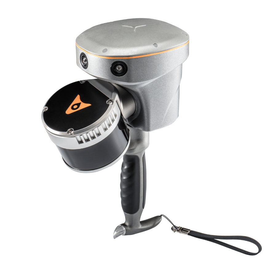
Revolutionize your surveying experience with the RS10 from CHCNAV, an innovative surveying slam solution integrating cutting-edge technologies for mapping and geospatial analysis. The RS10 combines GNSS RTK, laser scanning, and visual SLAM into a single, versatile platform designed to enhance the efficiency and accuracy of both indoor and outdoor 3D scanning and surveying tasks.
| Relative Accuracy |
Laser Scanner Range |
Channel |
Operating Temperature |
<1cm |
0.05 to 120 m
|
16 |
-20°C to +50°C |
With its 4th generation air dielectric GNSS antenna, the RS10 delivers RTK positioning accuracy of better than 3 cm, even in challenging environments. By fusing RTK, laser, and visual SLAM data, this system achieves an impressive 5 cm absolute measurement accuracy. Whether you're conducting detailed architectural surveys or tackling complex infrastructure projects, the RS10 empowers professionals to collect rich and precise data with ease.

|
|
|
|
|
Efficient Loop-Free WorkflowSay goodbye to traditional loop closure with the RS10's integration of high-precision GNSS and SLAM technologies. By enabling loop-free path planning, this system streamlines field data collection, reducing time and effort required to complete projects while ensuring data reliability. Experience the Future of Surveying with CHCNAV RS10. Operate in rover mode with CHCNAV LandStar™ software for easy use and minimal training. With hot-swappable batteries providing up to 60 minutes of runtime, the RS10 is always ready for action. And with CHCNAV's comprehensive software ecosystem, including CoProcess for instant drawing extraction, your surveying workflow has never been more efficient. |
 |