No Products in the Cart


Satellite-Grade Imagery at a Fraction of the Scale
Traditionally, vegetation and environmental monitoring relied on satellite imagery such as Landsat or Sentinel data. While effective, satellites offer spatial resolutions limited to around 10 meters per pixel. Our sensors deliver imagery at up to 2 centimeters per pixel through pan-sharpening technology, offering over 400 times finer detail. This resolution allows you to distinguish individual plants, detect early weed infestations, and track subtle changes in crop development and ecosystem health.
Consistent and Reliable Data Regardless of Lighting Conditions
Variability in sunlight can skew spectral data, complicating long-term monitoring. Our sensors utilize double radiometric calibration panels to normalize data, enabling reliable time-series analysis even in fluctuating natural light. This feature ensures that comparisons over days, weeks, or months remain scientifically valid and actionable.
Multispectral and RGB Data Fusion for Holistic Plant Insights
Capturing visible and invisible light, our sensors generate multiple outputs and vegetation indices, including NDVI, NDRE, OSAVI, CIR, PRI, and DSM to quantify plant health, stress, pigment concentration, and biomass. These indices help you analyze carotenes and anthocyanins, providing early indicators of plant disease or nutrient deficiencies that aren’t visible to the naked eye.
Seamless Integration and Ease of Use
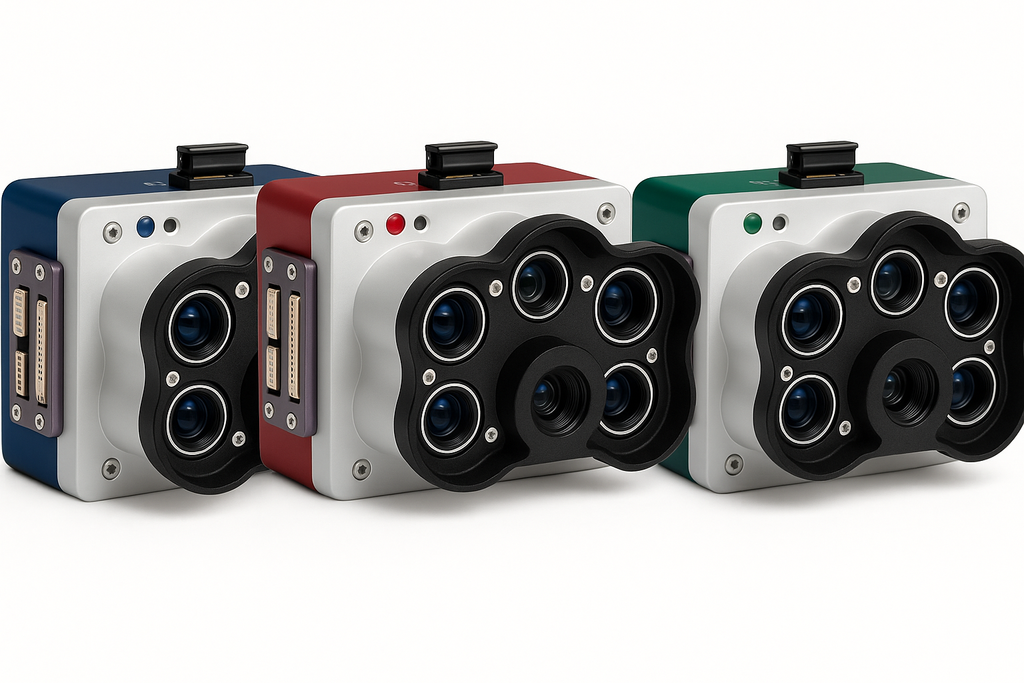
Compatible with most drone platforms and leveraging industry-standard interfaces such as USB, Ethernet, and serial connections, our sensors easily fit into your existing workflow without costly equipment overhauls. The compact, lightweight design (745 g total) and robust IP4X-rated housing ensure reliable operation in challenging field conditions.
Advanced Machine Learning and AI Applications
By providing high-quality, labeled datasets, our sensors enable advanced machine learning models for early-stage crop counting, weed detection, and invasive species identification. Automate time-intensive analysis and accelerate decision-making for improved conservation and agricultural management.
Versatile Environmental Applications
Beyond plant phenotyping, the sensors excel in monitoring coastal blue bands for shallow water analysis, managing water resources, surveying tidal zones, and conducting sensitive reef inspections inaccessible to vessels. Protect habitats and biodiversity by mapping erosion, monitoring swamps, and tracking glacier changes with unprecedented clarity.
Made in The USA
MicaSense series sensors are manufactured in the U.S. (NDAA compliant) and employed at academic, private and government institutions worldwide since 2014.
Industry Standard for Data Quality and Repeatability